Saturday 10 December 2011

Tibet

Today in the age of information with jet aircraft, highways and computer networks mysterious places are rare to be found; but Tibet is an exception. Refereed as Shangri La, The forbidden Land, The Roof of the World, and by many more, the mysterious Buddhist Kingdom remained long closed to foreigners, exerting a strong hold on the imagination of the world.
For centuries, it has fascinated mankind. It was hardly accessible to the outside world and has been always a challenge to human beings. Tibet, a "forbidden land" not only by man but also by nature, attracted many explorers, scholars, and pilgrims and adventure lovers, all in pursuit of "Real Shangri La".
It is not only the geographical and natural enchants but also a long historical culture and religion that appeal the foreigners to visit Tibet at least once in a lifetime.
Reservations
Deposit of full payment should be made to reserve the arrangements as per the regulation of Tibet Tourism Bureau at least 30 days before departure. Prices are quoted in United States Dollars. All payments must be made in US Dollar.
Method of Payment
All amount of payment should be made by telex transfer to our Account No: 10151A0, Himalayan Bank Limited, Tri Devi Marg, Kathmandu, Nepal, and we are to be advised of remittance by fax. Contact us for paying by Credit Card. Bank Draft and personal checks will not be accepted.

Documentation
You will be required to advise us the arrangement required of clients with details such as Full Name (exactly appears in the respective Passport), Date of Birth , Passport No, Date of issue, Date of Expiry, Sex, Nationality, Occupation and arrival/ departure flight/date information. Clients traveling to Tibet should arrive in Kathmandu at least 2 days prior to departure to Tibet to process the Tibet Visa with Chinese Embassy in Kathmandu as Chinese Embassy is open for visa application from 10 AM to 11 Am every Monday, Wednesday and Friday. If one wish to get the visa in one working day is also possible by paying surcharge of emergency visa fee. We advise to obtain double entry Nepal visa from Nepalese Embassy/Consulate abroad or obtain the same arrival at Kathmandu Airport.

Baggage Allowance
Free baggage allowance is 20 Kg per person.

Cancellation
Any cancellation made up to 10 days prior client's arrival in Kathmandu, 50% of total payment will be charged and if made less than 10 days before tour date, no refund will be made as per the policy of Tibet Tourism Bureau.

Refunds
No partial refunds will be given for unused rooms, meals, sightseeing trips or trekking arrangements for any reason whatsoever.

Risk & Liability
Travelers, who sign up for Tibet trips, will be exposed to health risk because of the nature of terrain and trail in Tibet. In the event of illness, accident or delays beyond our control, Getaway! Tours & Trekking (P) Ltd., or its agents will not be held responsible or liable for damages. Please keep in mind that you travel at your own risk.

Altitude Sikness
Those with chronic health problems should consult their doctor before making travel plans for Tibet. Most people visiting Tibet rarely suffer more than mild discomfort before getting acclimatized. Some people use DIAMOX to prevent the sickness. You will be in the higher passes for about half-an-hour. In fact, you are much less susceptible to high altitude sickness in Tibet, because you do not strain yourself. Please consult your doctor if in doubt . Drink lots of liquids.

Money
Money can be exchanged at Bank of China and its branches in Zhangmu, Xigatse and Lhasa. Hard currencies are exchanged for YUAN at approximately 8 YUAN to the US$ and is re-convertible at the said banks when leaving Tibet/China.

China Customs
Declare money and other valuables like jewelry and electronic goods while entering and also at exit. Any curios must be declared with proper receipts available only from Government Shops when leaving the country.

Responsibility
However, for loss arising from your change, unless reconfirmed by us, you should be responsible for this loss. IT&T has no responsibility for whatever change caused by weather and airliner service. Should there be any additional charges resulting from such changes, the clients are required to pay on the spot.

Time
Nepal Time is + 5:45 of Greenwich mean time and China time is 2 hours and 15 minutes ahead of Nepal time in winter and 3 hours and 15 minutes in the summer.

Road
Road between Kathmandu and Nyalam is bad and it can be disrupted during monsoon. Some parts above friendship bridge and above Zhangmu is not in condition to ply vehicles as such we have to walk about 3 hours above friendship bridge and above Zhangmu road about 2 hours. Porters are provided in these areas. During monsoon, if it rains heavily, road will be flooded with water between Xigatse and Gyantse, so we have to detour via Northern highway. We use Southern highway via Gyantse and Yamdrok Lake. It involves the crossing of a pass Karo - La which is 5010m high.

Food
The food is still bad at Zhangmu and Xegar. Since there are no restaurants along the way, we advise you to take few cans of sardine, dried fruits, biscuits etc. For return journey, you can buy at Lhasa. Also you can take a cup, spoon, tea and instant soup. Every guesthouse or hotel provides a big thermos full of hot water.

Saturday 3 December 2011

Nepal

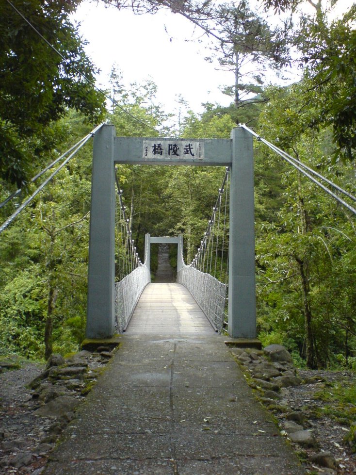
Nepal is a country of diversity. There are great geo-physical, climatic and biological diversity that have resulted diverse socio-economic and culture pattern in the country. It is the country that lies in the youngest fold mountain, Himalaya, of the world. It ranges from about 60 metre elevation to the 8848m, the highest point of the world. From the climatic point of view, it ranges from tropical to the tundra from south to north. It has covered an area of 147,181 sq km. This tiny country is yam between the giant nations of India and China but has remained unoccupied by any foreign nation throughout its history. Eighty-three percent of the total land mass is covered by rolling hills and high mountains. The only flat land is a narrow strip (at the widest 40 km) along the northern border of India that is covered by grasslands and sub-tropical forest. This Terai region is home to one-horned Rhino, Bengal tigers, elephants, sloth bears and many other indigenous animals. Nepal is landlocked nation with the nearest ocean port being 1,127 km away in India.

The southern belt is almost plain land and the northern belt is rocky and mountainous where there are thousands of snow peaks. \the Mahabharata range that lies in between these two belts is the gently sloping land having river valleys and Tars. This belt is gently sloping in the eastern part and more steep in the western part.

The country is mainly drained by the three major river systems namely Koshi, Gandaki and Karnali from east to west respectively. From the economic point of view, the Terai is the extensive agricultural belt, the midland is the fruit and grain crops growing area and the northern part is a very beautiful area suitable for tourist activities and livestock farming as well. In this way, diversity has been reflected in economic, social, cultural and other aspects of life. These make Nepal a unique country in the map of the world.
The average literacy rate of Nepal is 53.7%. Vast different exists between the male and female literacy rate. Out of the total male, 54.5% are literate whereas only 25.0 percent female are literate. Kathmandu is in the first position with 70.1% literacy rate. The lowest literacy rate is in Kalikot and Humla with literacy rate of 19.6% in each case.

History
According to myth, once upon a time the Kathmandu Valley was a great lake in the middle of which a brilliant flame burned from a lotus flower. Manjushri, a Buddhist from China, smote the lake with a magical sword and the water was drained from it. It is said that Swayambhu appeared in the flame when the Valley was formed. But according to the Hindu religion, Krishna created the valley, hurling a thunderbolt at the lake to create the Chorbar gorge.
The rivers of the valley do indeed flow southward through the narrow gorge and scientists agree that the valley was once submerged.

The recorded history of Nepal began with the reign of the Kiratis from the eastern part of the country. Yalamar, the first of their kings, is mentioned in the Hindu epic, The Mahabharata. During the Kirati period, Buddhism was introduced to the country.
Krakuchhanda Buddha, Kanak Muni Buddha and Kashyapa Buddha visited the Kathmandu valley to worship Swayambhunath. After Kiratis, the Lichhavis ruled from the 4th to the 7th century. The temple of Changunarayan was built in Licchavi period, and can still be seen today.

The Malla period was a golden era in Kathmandu valley, when great art, statues and temples were created. During the 147th century, Malla ruled for a total of 568 years. The country was divided into many small principalities and kingdoms, and the Kathmandu valley was divided into three states; Kantipur, Lalitpur & Bhaktapur.

In the tiny Kingdom of Gorkha, halfway between Kathmandu and Pokhara, the Shah dynasty gradually extended their power. In 1768, King Prithivi Narayan Shah defeated the Malla kings and Nepal has been ruled by Shah kings ever since. Our present king, His Majesty King Gyanendra Bir Bikram Shah Dev is the eleventh king in the shah dynasty.

Physical Feature of Nepal

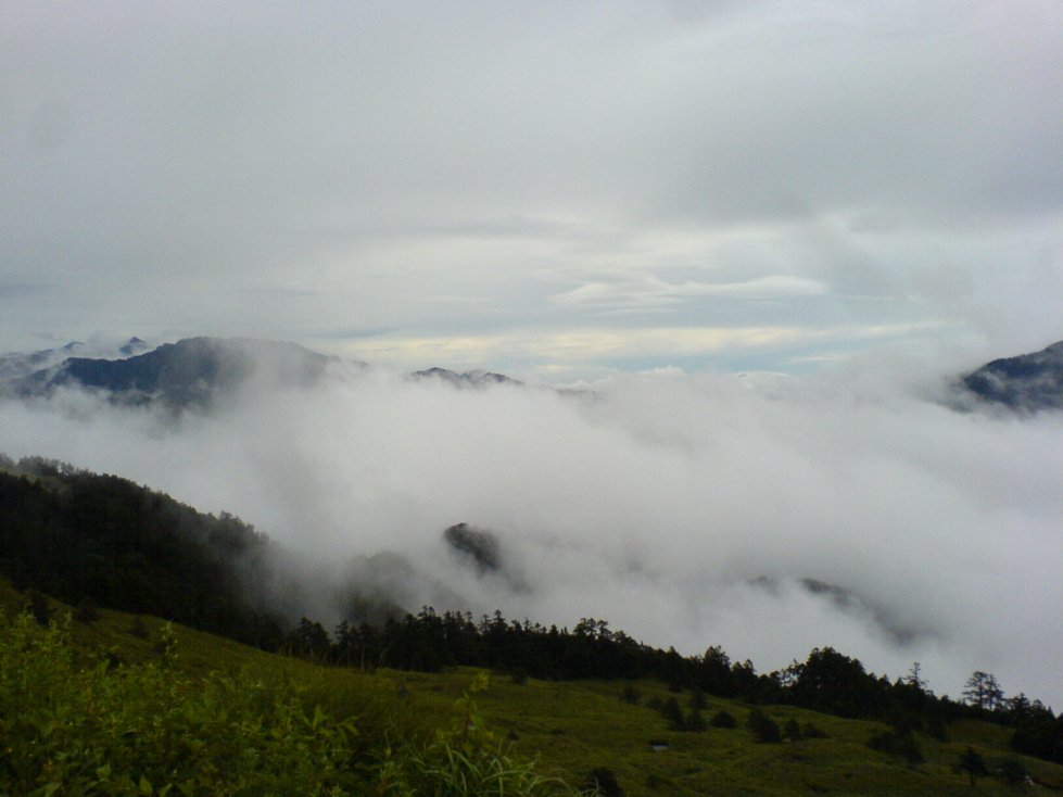
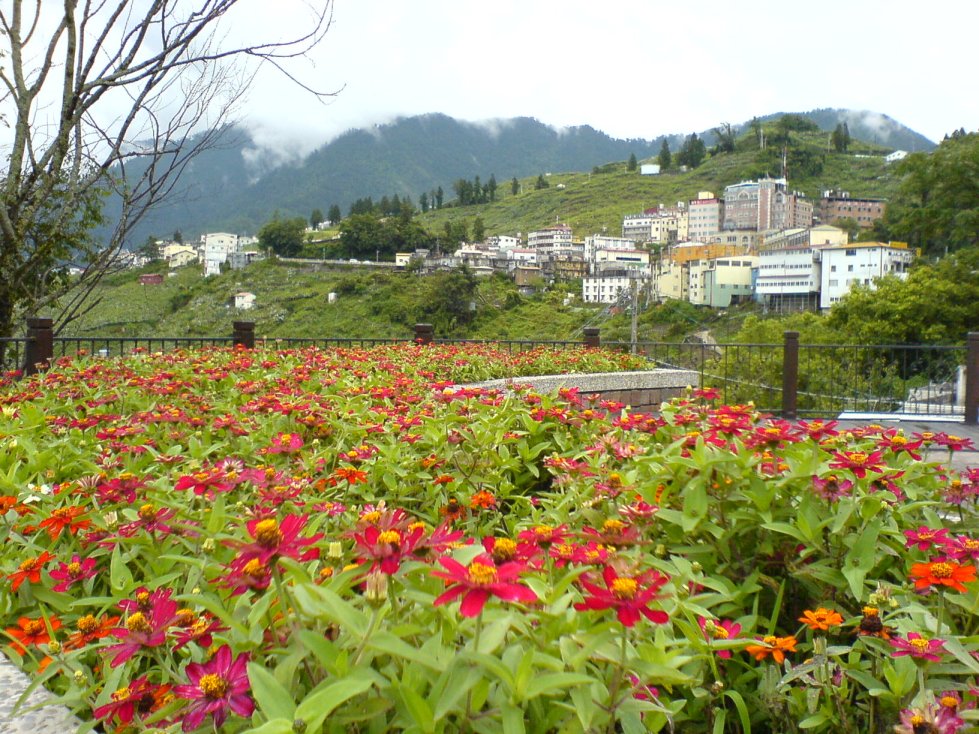
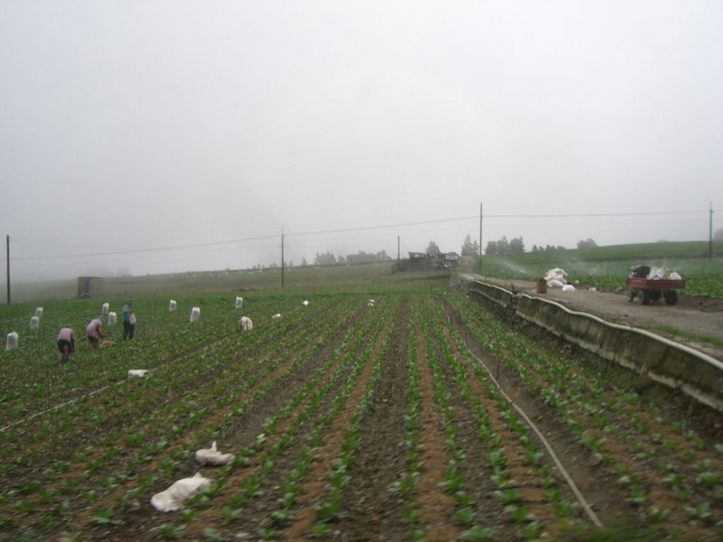
Nepal has diverse geo-ecological setting. It is the country of diversity. On the basis of altitude Nepal is divided into three divisions. These are Mountain, Hill and Terai. The Mountain lies in the northernmost part. It covers about 35 percent land area where only about 7 percent-cultivated land and about 8 percent population are found. The mountain lies above the altitude of 300 metre where there are a large number of magnificent snow-covered mountains, including the highest peak (Mt. Everest, 8,848m.) of the world. The Hill lies just below the Mountain. It covers about 42 percent land area, 44.5 percent population and 37 percent cultivated land. It lies between 600m to 3000m altitude. This region comprised several attractive peaks, fertile valleys and river basins. The Terai lies in the southern part of the country. It is elevated up to 600 meters from the sea level. It comprises 23 percent of the total land area, 49 percent population and 56 percent cultivated land. It has been formed out of alluvium brought and deposited by rivers. The land is fertile for agriculture where wide varieties of crops are grown.

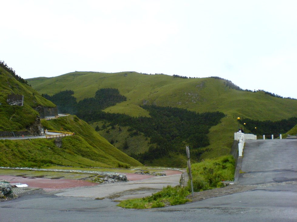
Physiography refers to the study of surface landform characteristics. Physiograpy of Nepal has been mainly divided on the basis of river, relief, structure, altitude and geographical distribution. Nepal is a mountainous country ranging from 60 metre to the summit of the world (Mt. Everest 8848m.) There are thousands of rivers flowing from north to south forming gorges, rivers and valley. There is a maxium relief, steep slope and rugged terrain. It has diverse geological and geographical structures that have resulted distinct landforms and topography. For the sake of convenience, the physiography of Nepal has been divided as High himal, High Mountain, Middle Mountain, Siwalik and Terai and Terai from north to south. Terai lies in the southern part. It is the palin land of altitude below 600 metre. The alluvial deposit froms it. The churiya lies just north of Terai, formed with conglometrates. Then the Middle Mountain extends widely. It lies between 900 to 3000 metre altitudes. It has spurs, hills river bvasins and valleys like kathandu and Pokhara. The High Mountain also has steep and dissected landforms. The High Himal is in the northernmost part where hundreds of snow peaks are found.

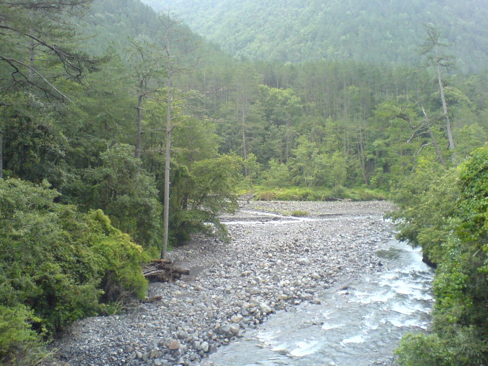
The elevation of Nepal ranges from about 60 metre to the summit of the world, Mt Everest, 8848 meters. Nepal is known as the second largest country after Brazil for water resources potential. They are Koshi, Gandaki and Karnali. Koshi with seven tributaries is the longest river in Nepal. Gandaki that flows in the central part also has seven main tributaries. Similarly, Karnali flows in the western part of the country.

The mountain, Hill and Terai regions have varied geological structure. The above map shows the distribution of about 30 different types of minerals. Most of the minerals are concentrated in the hill areas of the central and Western Development regions.
Nepal has given high priority to conserving and preserving the nature. There are eight national parks five widdlife reserves and four conservation areas in Nepal. The national parks, wildlife reserves and conservation areas have occupied 10144, 2398 and 11742 sq km area respectively.

Political Division of Nepal

Nepal has six tiers structure of the administrative division. Three structures from top to bottom are: Development Regions, Zones, Districts, llakas, Village Development Committees/Municipalities and Ward. In Nepal, there are five development regions, 14 zones, 75 districts and 3913 VDCs. There are 16 districts in EDR and 19, 16, 15, 9 districts in the CDR, WDR, MWDR and FWDR respectively. Out of 14 zones, karnali is the largest and Mahakali is the smallest in terms of area. Similarly, Dolpa has its own headquarters. Dhankuta, Kathmandu, Pokhara, Birendranagar and Dipayal are the regional headquarters of the Eastern, Central, Western, Mid Western and Far Western Development Regions respectively. Similarly, zones and districts also have their headquarters. Each VDC has its own VDC office.

Climate of Nepal

The generalization of climatic condition of Nepal is too difficult. It is varied within same altitude and latitude. This variation is resulted by the physical diversity of the country. Like the winter season, the temperature zones in summer also runs in east-west direction parallel to the topographic features. May, june and july are the months recording highest temperature.

Culture and Customs
Nepal is host to two main religions - Hinduism and Buddhism, two races, Caucasoid and Mongoloid and two civilizations, Indic and Sinic. Each ethnic group has its distinct identity. Although legislation banned it in the sixties, Polygamy is stilled practiced in some areas.

On entering a Nepalese home it is polite to remove your shoes. Some westernized Nepalese might not do it, but it is much appreciated. Many Hindu temples do not admit westerners to enter. Always walk clockwise around Buddhist stupas, chortens or mani walls. Shoes and any other leather items such as belts and bags must be removed before entering a Buddhist or Hindu temple Public displays of affection are not considered polite. Nor should you think of swimming naked in our rivers and lakes. In the northern hill area, polyandry, the custom of a wife having more than one husband, was also practiced till recently. For a widow to re-marry was not socially acceptable in some groups. An ethnic group such as the Brahmins were prohibited from drinking alcohol and sometimes practice vegetarianism. Brahmins met their spouse for the first time on the day of the wedding.

Religion
Hinduism and Buddhism share between them some 86.5 and 7.8 percent of the total population respectively. Their sense of fellow- feeling and bonhomie is evident in their worship of common deities and the joint celebration of many festivals. Buddhism was introduced in Kathmandu valley by Emperor Ashoka of India around 250 BC. Later, around 8th century AD, the ancestors of the Sherpas emigrated from Tibet bringing with them a form of Buddhism known as Ningmapa.

Gurungs, Tamangs, Serpas and Newars in the Kathmandu valley also follow Mahayaa Buddhism and the famous temple of Swayambhu in Kathmandu and the “Golden Temple” or the Hiranya Varna Mahabihar in Patan are visited mainly by Buddhist Newars.

A few people have adopted a complex blend of both Hinduism and Buddhism known as Bajrayana, which is mainly practiced in the Kathmandu valley. Apart from the Hindus and Buddhists, Muslims (3.5%) form the third largest religious group. There has also been an increase in the number of Christians in Nepal in recent years, now around 40,000 - about 1% of the population and 1.2 percent of other religions.

People

Nepal is a multi ethnic, multi lingual,secular, democratic country.. She has population of more than 26 Million, made up of an assortment of races and tribes, living in different regions. They live under quite diverse environmental conditions from the low, nearly sea level plains at the border of India, northward through the middle hills and valleys and up to the flanks of the great Himalayan range where there are settlements at altitude of up to 4,800m. Farming practices are therefore equally diverse along with life styles and social customs.

Tibetan speaking people are found on the high Himalayan region. Life here is delicate balance of hard work and social merrymaking, tempered by a culture deeply steeped in ancient religious traditions. The best known of the high mountain peoples are the Sherpas who inhabit the central and eastern regions of Nepal. The Sherpas have easy access to Bhot (Tibet) for trade and social intercourse and therefore Tibetan influence on their culture and civilization remains distinct. The midlands are inhabited by various Tibeto-Burman and Indo-Aryan speaking hill and valley people, for example the Brahmins, Chettris, and Newars. While the Brahmins and Chettris are widely distribute through out the country, the Newars are mainly concentrated in the Katmandu Valley and other towns.

The Rais, Limbus, Tamangs, Magars, Sunwars, Jirels, Gurungs, Thakalis, and Chepangs are other Tibeto-Burman speaking Mongoloid peole found living in the middle hills. They each have their own distinct social and cultural patterns. The Dun valleys and the lowland Terai are inhabited by people such as the Brahmins, Rajputs, Tharus, Danwars, Majhis, Darais, Rajbansis, Statars, dhimals and Dhangars. Though Nepal is a veritable mosaic of dozens of ethnic groups, they are bound together by their ideas of peaceful coexistence and religious tolerance to form one unified nation.

Among the low Caste groups Kumals are also a integral part. The world is in 21st century but the condition of these people is not better than the people of 16th century. In the age of science, this people are still fighting to get their actual place in the society. These people are ignored, dominated by the upper Caste people.

Although the caste system still exists, particularly in rural Nepal...it is weakening. There is an increasing desire among many Nepali people (particularly the younger generation) to see the end of this discrimination. And it will happen...in fact, is happening?but it takes time to change 2500 years of tradition.

India

India is set apart from the rest of Asia by the Himalayas, the highest, youngest and still evolving mountain chain on the planet. The subcontinent as it is rightly called, touches three large water bodies and is immediately recognizable on any world map. This thick, roughly triangular peninsula defines the Bay of Bengal to the east, the Arabian sea to the west, and the India Ocean to the south.
India holds virtually every kind of landscape imaginable. An abundance of mountain ranges and national parks provide ample opportunity for eco-tourism and trekking, and its sheer size promises something for everyone. From north to south India extends a good 2000 miles (3200 km), where the island nation of Sri Lanka seems to be squeezed out of India like a great tear, the synapse forming the Gulf of Mannar.
Himalayas, the world's highest mountain chain and Nepal as its Neighbouring country dominate India's northern border. Following the sweeping mountains to the northeast, its borders narrow to a small channel that passes between Nepal, Tibet, Bangladesh, and Bhutan, then spreads out again to meet Burma in the "eastern triangle." Apart from the Arabian Sea, its western border is defined exclusively by Pakistan.
North India is the country's largest region begins with Jammu and Kashmir, with terrain varying from arid mountains in the far north to the lake country and forests near Srinagar and Jammu. Moving south along the Indus river, the North becomes flatter and more hospitable, widening into the fertile plains of Punjab to the west and the Himalayan foothills of Uttar Pradesh and the Ganges river valley to the East. Cramped between these two states is the capital city, Delhi.

The states of Gujarat, Maharashtra, Goa, and part of the massive, central state of Madhya Pradesh constitute West India. Extending from the Gujarat peninsula down to Goa, the west coast is lined with some of India's best beaches. The land along the coast is typically lush with rainforests. The Western Ghats separate the verdant coast from the Vindya Mountains and the dry Deccan plateau further inland.

India is the home of the sacred River Ganges and the majority of Himalayan foothills, East India begins with the states of Madhya Pradesh, Bihar, Orissa, which comprise the westernmost part of the region. East India also contains an area known as the eastern triangle, which is entirely distinct. This is the last gulp of land that extends beyond Bangladesh, culminating in the Naga Hills along the Burmese border.

India reaches its peninsular tip with South India, which begins with the Deccan in the north and ends with Cape Comorin. The states in South India are Karnataka, Andhra Pradesh, Tamil Nadu, and Kerala, a favourite leisure destination. The southeast coast, mirroring the west, also rests snugly beneath a mountain range---the Eastern Ghats.

The main way to travel to India from furthest countries is flying. The shortest international flight to India is 148 miles. There are four main airports in India, including Mumbai, Delhi, Chennai and Kolkata, and plenty of minors, such as Bangalore, Hyderabad, Amritsar, Ahmedabad, Calicut, Cochin, Coimbatore Airports and number of others. These airports are working with a lot of airlines (over 80 air companies) that provides their service for different prices, so if you want to get the cheap flight to India, you should take interest in special offers of air companies. In addition to this, the multiple airline flights are also the possibility to get cheap flights to India. There are event 354,672 weakly international flights to and from India.

Moreover, if you are looking for cheap flight to India, you should know that airports usually has their own fees, so sometimes flying from the smaller airport is the cheaper choice than taking the flight from the main airport in the country. By the way, it is observed that the cheapest tickets are some months before the flight and they are getting expense with every day closer to the date of departure. So the travel specialists advise to plan your travel to India as early as it is possible.

Thursday 24 November 2011

Taipei

Sunset


Missing those days when I don't work at night,
just staring from my window and enjoying
the Sunset.

Quail Eggs

One of the street food in Night Market

Plum

First time to see Plums


Here are Plum Trees

Nangang MRT Station

The latest Metro Station in Taipei

Tuesday 22 November 2011

The Beach

I seized the moment to mix work with pleasure. Thus, the beautiful white sand beaches and the clear blue sea of Philippine's famous Boracay island.

Behold the beach!

Early morning beauty of Boracay!

This is Paradise! the other end of Boracay!

Thursday 17 November 2011

Lishan and Wuling Farm


Hehuan Villa

and its surroundings

view just outside Hehuan Villa, that is how high we are!

Lishan's surroundings, with the many different colorful flowers decorating the area


little puppy that disturbed me while i was waiting for bus haha

Wuling Farm surroundings


another close up of a butterfly

peaches!

and pears!

Wuling hanging bridge

the tall and slender Wuling Waterfall


the forest trails

forest spa is good for health!

a meter or something they use to warn about forest fires

Wuling Farm and Taipei...

went out for a early morning stroll in the forest and farms...before i realise it, i was going to be late for my bus to Yilan (宜蘭) from where i will take train back to Taipei...quickly pack up and then begin to walk that damn 5 km to the bus stop...walked about 1km and saw a lorry driving down the same direction...thinking that i might be able to hitchhike, i stopped the lorry and they were kind enough to let me mount the back of the lorry for a free ride...phew...no more walking with my heavy backpack haha...the back of the lorry was filled with cabbages...lots of them...probably freshly harvested from their farm...reached the bus stop and thanked them for their wonderful help...met a old couple at the bus stop and chatted with them...realise they are from China and has bought a piece of farm land and build a house here to prepare for their retirement...how i wish i could be like them when i am old to be able to retire in such a wonderful environment...bus came and took around 2 hrs odd to reach Yilan...another wonderful bus ride thru magnificient mountains sceneries...from there i took the latest train back to Taipei...went back to Taiwanmex Guest House again since i really like it there...got back the same room i lived before i left Taipei that time...but this time, i have the whole 4 person dorm to myself wahahaha...chatted with a Canadian guy in the living room...he is actually my age and has came here to teach english for a year...in fact, many foreigners do come Taiwan to teach english and they do get quite a good salary for just working few hours a day...went to window shop at Taipei and Zhongshan underground mall before hitting Wufenpu and Raohe Night Market again haha...this time i manage to walk till the end of Raohe NM and stuffed myself with lots and lots of foods lol...once again someone asked me if i wanna work at her shop...wtf lol...went back to Taipei Station and exited thru the south entrance...there is actually this little square compound there and there are numerous pillars that glow in different light color...kinda nice...and there are also a few caucasians skateboarding there...so i just sat and watch them perform various stunts while enjoying the mini lightshow...wented back to hostel...a group of people crowded around the living room...it was ladies night and they were going clubbing and ask me along...but i kindly reject since i was really tired and my legs were already hurting from the trekking and walking haha...finally bought my return flight to singapore on 31st July since i needed to do my module bidding then...else i will have stayed longer!

strange maple tree whose leaves were still red now...something wrong with its biological clock maybe haha

Wuling bus stop

farmers working hard

Taipei 101 And Shilin Night Market

went to the majestic Chiang Kai-shek Memorial Hall (國立中正紀念堂) in the morning, just in time to see the change of guards ceremony...it was really formal, but their creative drill patterns are definitely worth looking out for...there is also a museum dedicated to Chiang Kai-shek (蔣介石) where you get to learn about his life and how he became the 1st president of Taiwan...the whole compound is actually very big and includes the National Theatre (國家戲劇院) and National Concert Hall (國家音樂廳) with a gigantic square in the middle of the 3 buildings...there were many students and teenagers around the complex too...some practising their dance routines while others perfecting their Chinese calligraphy...then headed to the awesome Taipei 101...standing at incredible height of 509m, it is the tallest building in the world then and was built to resemble a stalk of bamboo...walked around, some window shopping and had a light breakfast there...mainly branded stuffs there...so not for a poor man like me =/...stopped by at the Sun-Yet-Sen Memorial Hall (國立國父紀念館) and a art gallery that was on-going there before going to SOGO to help my friend buy some stuffs...but it was closed due to a fire that broke out the day before...zzzzzzzz...how unlucky i can get!...went to Shilin Night Market in the late evening and spent almost like 4 hrs there lol...shopping and eating...bought lots of clothings =p...tried 考香雞排...tasted just as nice as 炸香雞排 or maybe even better...check out lots of pet shops there too...and the American Shorthair cats really caught my eyes...they are really cute and active haha...really wish i could have one at home...went back to the hostel and chatted with the owner whom we call Xu xiao jie...she told me there was actually a 6.1 scale earthquake early morning that day...strangely i didn't felt it...damn...maybe i was in the MRT or something...we also talked about traveling around the world and stuffs...and she really has good knowledge about the different countries since she probably had met countless foreigners from all over the world...really a wonderful woman she is!


Gate of Great Centrality and Perfect Uprightness (大中至正), front entrance to the big square compound of C.K.S. Memorial

outside of the majestic C.K.S. Memorial Hall

there is a total of 89 steps, which symbolises the age of Chiang Kai-shek when he died

inside of C.K.S. Memorial Hall where you can see a big bronze sculpture of the man himself
the 3 main themes of the Chinese characters at the back are Ethics, Democracy and Science


view of the big compound from the top

here come the smartly-dressed guards

changing of guards ceremony

performing some fancy stunts with their rifles

Taipei 101, the tallest building in the world then

Taipei 101 as seen from Sun-Yat-Sen Memorial

Sun-Yat-Sen, the father of modern China